
By: Melanie Kammerer | 10/13/2021 USDA-ARS, ORISE Fellow, SCINet Pollinator Working Group

Melanie is an ORISE Fellow within the SCINet Office. Melanie completed her PhD in Ecology at Penn State University where she studied landscape and climate drivers of Wild Bee Communities. She leads the SCINet Pollinator Working Group.
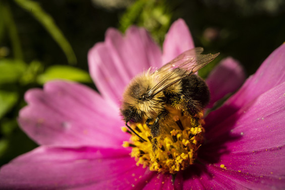
Flowers provide critical nectar and pollen resources to support foraging, learning and memory, and reproduction of pollinating insects, but there are very few large-scale maps of floral resources for pollinators. As part of my post-doctoral research supported by SCINet, I am developing a data-driven method to map floral resources at large geographic extents by scaling-up field observations of plant communities. My colleagues and I are integrating previously disparate datasets that describe ‘who, when, where, and how much’ flowering occurs in 23 habitat types in the Northeast USA.
Our approach is unique because it generates relatively fine-scale temporal predictions of floral area over large spatial extents, relevant for apicultural, agricultural, and conservation decisions. With this large, integrated dataset on flowering, for a given location in the Northeast, we can estimate monthly (or even weekly) quantities of flowers available for pollinators across a landscape. Some wild-bee species are active for a very short segment of the growing season but forage up to 1-5km from their nests (or more in times of resource scarcity), necessitating a combination of fine temporal and broad spatial data. This work will enable researchers, land owners, and conservation professionals to identify temporal and spatial gaps in available flowers and design pollinator plantings to mitigate resource scarcity (recently highlighted as federal research priority in the 2021 USDA Annual Strategic Pollinator Priorities and Goals Report.
SCINet note: Our team used SCINet’s Atlas HPC to create national habitat maps that we could combine with field surveys to map floral area. This workflow involved merging two pre-existing habitat maps (USDA NASS Cropland Data Layer with the LANDFIRE National Vegetation Classification). Using the Atlas ‘big memory’ nodes, we completed the geospatial merge for the conterminous United States in less than one day which will allow us to create annual habitat maps for multiple years (2010-2020 expected output).